Kategorier i Lostock
Bransjer
Bedriftsfordeling etter bransje i Lostock
| Bransjebeskrivelse | Antall bedrifter |
|---|---|
| Offentlige parker | 6 |
| Reisebyråer | 5 |
| Campingplasser | 5 |
Lostock fakta
| Område | 60.3 km² |
| Befolkning | 43 |
| Befolkningsendring (1975 to 2020) | -69.3% |
| Befolkningsendring (2000 to 2020) | -14.0% |
| BNP per innbygger (PPP) | $32 693 (2022) |
| Lokal tid | |
| Tidssone | østaustralsk normaltid |
| Bredde- & lengdegrad | -32.33333, 151.45000 |
| Postnumre | 2311 |
Kart over Lostock
Interaktivt kart
Lostock befolkning
Årene 1975 til 2030
| Data | 1975 | 1990 | 2000 | 2015 | 2020 | 2025* | 2030* |
|---|---|---|---|---|---|---|---|
| Befolkning | 140 | 40 | 50 | 59 | 43 | 43 | 44 |
| Befolkningstetthet | 2,3 / km² | 0,7 / km² | 0,8 / km² | 1 / km² | 0,7 / km² | 0,7 / km² | 0,7 / km² |
* Prognostisert
Kilder: JRC (European Commission's Joint Research Centre) arbeid med GHS built-up gridLostock befolkningsendring fra 2000 til 2020
Nedgang på 14% fra 2000 til 2020
| Beliggenhet | Endring siden 1975 | Endring siden 1990 | Endring siden 2000 |
|---|---|---|---|
| Lostock | -69.3% | +7.5% | -14% |
| New South Wales | — | — | — |
| Australia | — | — | — |
Kilder: JRC (European Commission's Joint Research Centre) arbeid med GHS built-up grid
Lostock befolkningstetthet
Befolkningstetthet: 0,7 / km²
| Beliggenhet | Befolkning | Område | Tetthet |
|---|---|---|---|
| Lostock | 43 | 60,3 km² | 0,7 / km² |
| New South Wales | 7,7 million | 801 634,1 km² | 9,6 / km² |
| Australia | 23,8 million | 7 690 961,5 km² | 3,1 / km² |
Kilder: JRC (European Commission's Joint Research Centre) arbeid med GHS built-up grid
Lostock historisk og prognostisert befolkning
Estimert befolkning fra 0 til 2100
Kilder:
- JRC (European Commission's Joint Research Centre) arbeid med GHS built-up grid
- CIESIN (Center for International Earth Science Information Network)
- [link] Klein Goldewijk, K., Beusen, A., Doelman, J., and Stehfest, E.: Anthropogenic land use estimates for the Holocene – HYDE 3.2, Earth Syst. Sci. Data, 9, 927–953, https://doi.org/10.5194/essd-9-927-2017, 2017.
Human Development Index (HDI)
Statistisk sammensatt indeks over forventet levealder, utdanning og inntekt per innbygger.
Kilde: [link] Kummu, M., Taka, M. &Guillaume, J. Gridded global datasets for Gross Domestic Product and Human Development Index over 1990–2015. Sci Data 5, 180004 (2018) doi:10.1038/sdata.2018.4
Lostock bruttonasjonalprodukt (BNP)
BNP per innbygger, PPP (faste internasjonale dollar fra 2017)
| Data | 1990 | 1995 | 2000 | 2005 | 2010 | 2015 | 2020 | 2022 |
|---|---|---|---|---|---|---|---|---|
| BNP per innbygger | $28 501 | $31 972 | $39 481 | $42 678 | $39 721 | $40 328 | $31 762 | $32 693 |
| Totalt BNP | $491,6k | $558,2k | $636,4k | $644k | $577,8k | $556k | $418,4k | $425k |
Kilde: [link] Kummu, M., Kosonen, M. & Masoumzadeh Sayyar, S. Downscaled gridded global dataset for gross domestic product (GDP) per capita PPP over 1990–2022. Sci Data 12, 178 (2025) doi:10.1038/s41597-025-04487-x
Lostock CO2-utslipp
Utslipp av karbondioksid (CO2) per innbygger i tonn per år
| Beliggenhet | CO2-utslipp | CO2-utslipp per innbygger | CO2-utslippsintensitet |
|---|---|---|---|
| Lostock | 788 tn | 18.32 tn | 13.1 tons/km² |
| New South Wales | 133,365,481 tn | 17.39 tn | 166.4 tons/km² |
| Australia | 401,155,564 tn | 16.88 tn | 52.2 tons/km² |
Kilder: [link] Moran, D., Kanemoto K; Jiborn, M., Wood, R., Többen, J., and Seto, K.C. (2018) Carbon footprints of 13,000 cities. Environmental Research Letters DOI: 10.1088/1748-9326/aac72a
Lostock CO2-utslipp
| CO2-utslipp i 2013 (tonn/år) | 788 tn |
| CO2-utslipp i 2013 (tonn/år) per person | 18.32 tn |
| CO2-utslippsintensitet i 2013 (tonn/km²/år) | 13.1 tons/km² |
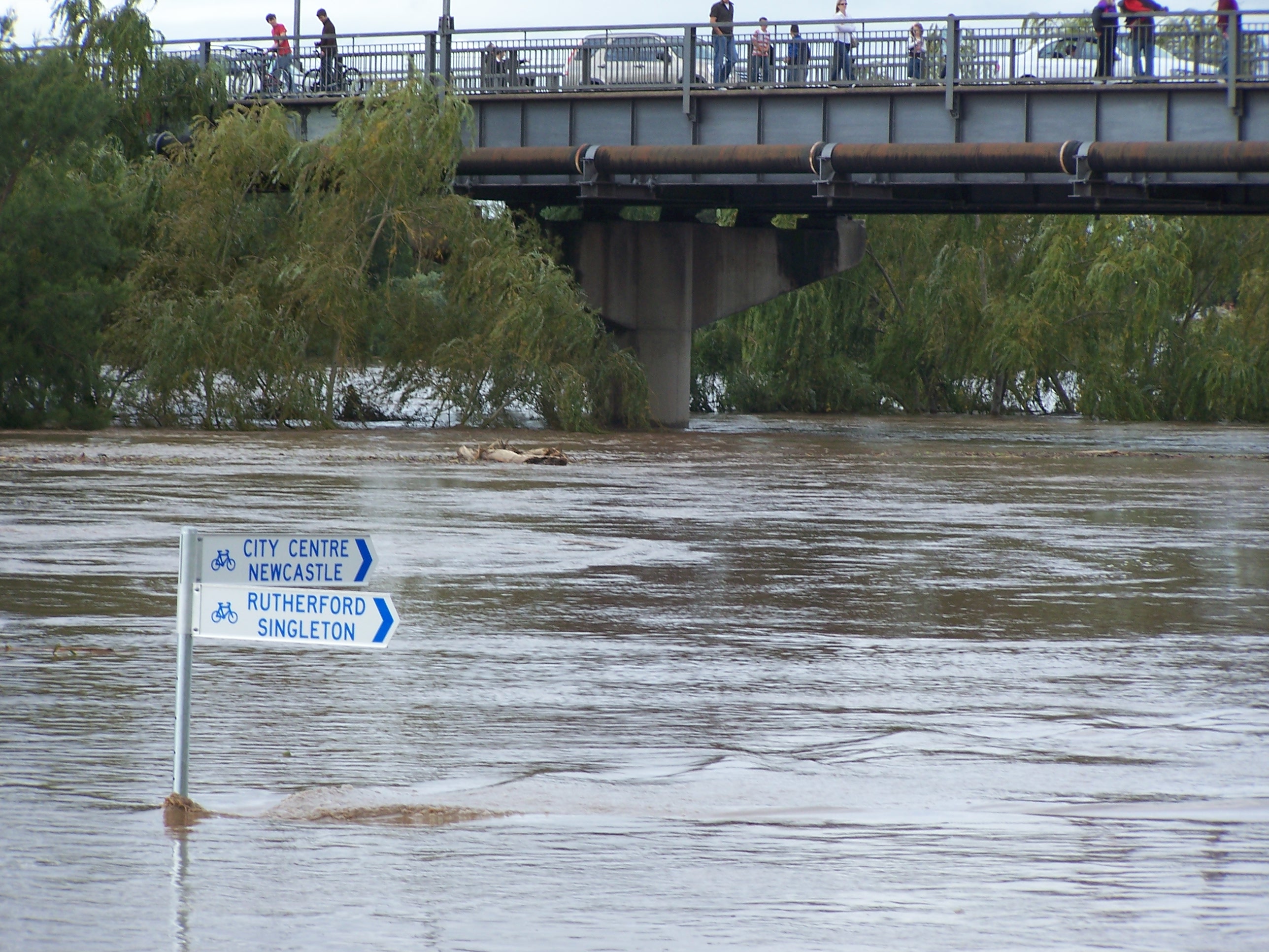
Naturlige farer
Relativ risiko av 10
| Fare | Risikonivå |
|---|---|
| Tørke | Middels (4) |
| Oversvømmelse | Høy (8) |
| Jordskjelv | Middels (4) |
* Risiko, spesielt for flom eller skred, kan ikke være for hele området.
Kilder:
- Dilley, M., R.S. Chen, U. Deichmann, A.L. Lerner-Lam, M. Arnold, J. Agwe, P. Buys, O. Kjekstad, B. Lyon, and G. Yetman. 2005. Natural Disaster Hotspots: A Global Risk Analysis. Washington, D.C.: World Bank. https://doi.org/10.1596/0-8213-5930-4.
- Center for Hazards and Risk Research - CHRR - Columbia University, Center for International Earth Science Information Network - CIESIN - Columbia University, and International Research Institute for Climate and Society - IRI - Columbia University. 2005. Global Drought Hazard Frequency and Distribution. Palisades, NY: NASA Socioeconomic Data and Applications Center (SEDAC). https://doi.org/10.7927/H4VX0DFT.
- Center for Hazards and Risk Research - CHRR - Columbia University, Center for International Earth Science Information Network - CIESIN - Columbia University. 2005. Global Flood Hazard Frequency and Distribution. Palisades, NY: NASA Socioeconomic Data and Applications Center (SEDAC). https://doi.org/10.7927/H4668B3D.
- Center for Hazards and Risk Research - CHRR - Columbia University, Center for International Earth Science Information Network - CIESIN - Columbia University. 2005. Global Earthquake Hazard Distribution - Peak Ground Acceleration. Palisades, NY: NASA Socioeconomic Data and Applications Center (SEDAC). https://doi.org/10.7927/H4BZ63ZS.
Nylige jordskjelv i nærheten
Størrelse 3.0 og større
| Dato▼ | Tid↕ | Magnitude↕ | Distance↕ | Dybde↕ | Beliggenhet↕ | link |
|---|---|---|---|---|---|---|
| 9/14/18 | 9:51 PM | 3.9 | 61.2 km | 10,000 m | 11km E of Denman, Australia | usgs.gov |
| 3/11/10 | 4:25 PM | 3.3 | 81.9 km | 0 m | near the southeast coast of Australia | usgs.gov |
| 8/6/94 | 11:03 AM | 5.3 | 72.1 km | 10,000 m | near the southeast coast of Australia | usgs.gov |
| 2/23/90 | 12:43 PM | 3 | 90.2 km | 10,000 m | New South Wales, Australia | usgs.gov |
| 12/27/89 | 11:26 PM | 5.4 | 72 km | 10,000 m | near the southeast coast of Australia | usgs.gov |


Om våre data
Dataene på denne siden er estimert ved hjelp av en rekke offentlig tilgjengelige verktøy og ressurser. De leveres uten garanti og kan inneholde unøyaktigheter. Bruk på eget ansvar.