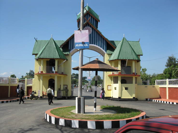
Kategorier i Thoubāl
Bransjer
Bedriftsfordeling etter bransje i Thoubāl
| Bransjebeskrivelse | Antall bedrifter |
|---|---|
| Handling | 732 |
| Undervisning | 663 |
| Leiligheter | 318 |
| Religion | 291 |
| Elektronikkbutikker | 289 |
| Lekeplass | 277 |
| Reise og transport | 249 |
| Matbutikker og supermarkeder | 214 |
| Andre medlemsorganisasjoner | 209 |
| Kirker | 183 |
| Moskeer | 182 |
| Handling annet | 169 |
| Apoteker | 155 |
Thoubāl fakta
| Område | 268.7 km² |
| Befolkning | 260 131 |
| Mannlig befolkning | 129 817 (49.9%) |
| Befolkning av kvinner | 130 314 (50.1%) |
| Befolkningsendring (1975 to 2020) | +127.2% |
| Befolkningsendring (2000 to 2020) | +33.2% |
| Gjennomsnittsalder | 24.7 år (Menn: 24.4, Kvinner: 24.9) |
| BNP per innbygger (PPP) | $4 779 (2022) |
| Nabolag | Wangmataba, Meira Paibi, Awang Leikai, Mamang Leikai, Ward Number 1, Wangmataba |
| Lokal tid | |
| Tidssone | indisk tid |
| Bredde- & lengdegrad | 24.63881, 93.99639 |
| Postnumre | 795103, 795130, 795135, 795138, 795148, More |
Kart over Thoubāl
Interaktivt kart
Thoubāl befolkning
Årene 1975 til 2030
| Data | 1975 | 1990 | 2000 | 2015 | 2020 | 2025* | 2030* |
|---|---|---|---|---|---|---|---|
| Befolkning | 114 497 | 162 207 | 195 238 | 238 894 | 260 131 | 273 382 | 286 865 |
| Befolkningstetthet | 426,1 / km² | 603,7 / km² | 726,6 / km² | 889,1 / km² | 968,2 / km² | 1 017,5 / km² | 1 067,7 / km² |
Thoubāl befolkningsendring fra 2000 til 2020
Økning på 33.2% fra 2000 til 2020
| Beliggenhet | Endring siden 1975 | Endring siden 1990 | Endring siden 2000 |
|---|---|---|---|
| Thoubāl | +127.2% | +60.4% | +33.2% |
| Manipur | — | — | — |
| India | — | — | — |
Thoubāl medianalder
Medianalder: 24.7 år
| Beliggenhet | Gjennomsnittsalder | Median alder (kvinne) | Median alder (mann) |
|---|---|---|---|
| Thoubāl | 24.7 yrs | 24.9 yrs | 24.4 yrs |
| Manipur | 24.9 yrs | 25.2 yrs | 24.6 yrs |
| India | 24.9 yrs | 25.4 yrs | 24.5 yrs |
Thoubāl befolkningstetthet
Befolkningstetthet: 968 / km²
| Beliggenhet | Befolkning | Område | Tetthet |
|---|---|---|---|
| Thoubāl | 260 131 | 268,7 km² | 968 / km² |
| Manipur | 3,2 million | 22 308,8 km² | 144 / km² |
| India | 1 307 million | 3 083 563,4 km² | 424 / km² |
Thoubāl historisk og prognostisert befolkning
Estimert befolkning fra 1740 til 2100
- JRC (European Commission's Joint Research Centre) arbeid med GHS built-up grid
- CIESIN (Center for International Earth Science Information Network)
- [link] Klein Goldewijk, K., Beusen, A., Doelman, J., and Stehfest, E.: Anthropogenic land use estimates for the Holocene – HYDE 3.2, Earth Syst. Sci. Data, 9, 927–953, https://doi.org/10.5194/essd-9-927-2017, 2017.
Nabolag i Thoubāl
Prosentandel av bedrifter etter nabolag i Thoubāl
Retningsnumre
Prosent Områdekoder bruk av bedrifter i Thoubāl
Postnumre
Prosentandel av bedrifter etter postnummer i Thoubāl
Human Development Index (HDI)
Statistisk sammensatt indeks over forventet levealder, utdanning og inntekt per innbygger.
Thoubāl bruttonasjonalprodukt (BNP)
BNP per innbygger, PPP (faste internasjonale dollar fra 2017)
| Data | 1990 | 1995 | 2000 | 2005 | 2010 | 2015 | 2020 | 2022 |
|---|---|---|---|---|---|---|---|---|
| BNP per innbygger | $1 219 | $1 622 | $2 534 | $3 062 | $2 943 | $3 631 | $4 137 | $4 779 |
| Totalt BNP | $100,4 mill. | $147,9 mill. | $251,8 mill. | $329,1 mill. | $336,4 mill. | $440,3 mill. | $533,7 mill. | $629,8 mill. |
Thoubāl CO2-utslipp
Utslipp av karbondioksid (CO2) per innbygger i tonn per år
| Beliggenhet | CO2-utslipp | CO2-utslipp per innbygger | CO2-utslippsintensitet |
|---|---|---|---|
| Thoubāl | 313,694 tn | 1.21 tn | 1,167.5 tons/km² |
| Manipur | 3,768,697 tn | 1.18 tn | 168.9 tons/km² |
| India | 1,928,568,344 tn | 1.48 tn | 625.4 tons/km² |
| CO2-utslipp i 2013 (tonn/år) | 313,694 tn |
| CO2-utslipp i 2013 (tonn/år) per person | 1.21 tn |
| CO2-utslippsintensitet i 2013 (tonn/km²/år) | 1,167.5 tons/km² |
Naturlige farer
Relativ risiko av 10
| Fare | Risikonivå |
|---|---|
| Tørke | Middels (4) |
| Oversvømmelse | Middels (7) |
| Jordskjelv | Høy (10) |
| Jordskred | Høy (8) |
* Risiko, spesielt for flom eller skred, kan ikke være for hele området.
- Dilley, M., R.S. Chen, U. Deichmann, A.L. Lerner-Lam, M. Arnold, J. Agwe, P. Buys, O. Kjekstad, B. Lyon, and G. Yetman. 2005. Natural Disaster Hotspots: A Global Risk Analysis. Washington, D.C.: World Bank. https://doi.org/10.1596/0-8213-5930-4.
- Center for Hazards and Risk Research - CHRR - Columbia University, Center for International Earth Science Information Network - CIESIN - Columbia University, and Norwegian Geotechnical Institute - NGI. 2005. Global Landslide Hazard Distribution. Palisades, NY: NASA Socioeconomic Data and Applications Center (SEDAC). https://doi.org/10.7927/H4P848VZ.
- Center for Hazards and Risk Research - CHRR - Columbia University, Center for International Earth Science Information Network - CIESIN - Columbia University, and International Research Institute for Climate and Society - IRI - Columbia University. 2005. Global Drought Hazard Frequency and Distribution. Palisades, NY: NASA Socioeconomic Data and Applications Center (SEDAC). https://doi.org/10.7927/H4VX0DFT.
- Center for Hazards and Risk Research - CHRR - Columbia University, Center for International Earth Science Information Network - CIESIN - Columbia University. 2005. Global Flood Hazard Frequency and Distribution. Palisades, NY: NASA Socioeconomic Data and Applications Center (SEDAC). https://doi.org/10.7927/H4668B3D.
- Center for Hazards and Risk Research - CHRR - Columbia University, Center for International Earth Science Information Network - CIESIN - Columbia University. 2005. Global Earthquake Hazard Distribution - Peak Ground Acceleration. Palisades, NY: NASA Socioeconomic Data and Applications Center (SEDAC). https://doi.org/10.7927/H4BZ63ZS.
Nylige jordskjelv i nærheten
Størrelse 3.0 og større
| Dato▼ | Tid↕ | Magnitude↕ | Distance↕ | Dybde↕ | Beliggenhet↕ | link |
|---|---|---|---|---|---|---|
| 3/25/19 | 12:41 PM | 4.6 | 60.9 km | 56,650 m | 16km W of Churachandpur, India | usgs.gov |
| 2/3/19 | 5:20 PM | 4.5 | 17.2 km | 66,280 m | 10km S of Mayang Imphal, India | usgs.gov |
| 1/27/19 | 11:45 PM | 4.7 | 26.2 km | 65,340 m | 9km SSE of Kakching, India | usgs.gov |
| 1/27/19 | 4:49 AM | 4.7 | 36 km | 67,970 m | 28km ENE of Yairipok, India | usgs.gov |
| 1/25/19 | 5:07 PM | 4.6 | 38 km | 55,870 m | 21km SSW of Kakching, India | usgs.gov |
| 11/6/18 | 10:50 PM | 4.2 | 44.9 km | 64,340 m | 37km ESE of Kakching, India | usgs.gov |
| 9/25/18 | 8:51 PM | 4.2 | 44.3 km | 57,720 m | 26km ESE of Churachandpur, India | usgs.gov |
| 6/20/18 | 7:44 AM | 4.5 | 38.3 km | 67,380 m | 31km ESE of Yairipok, India | usgs.gov |
| 3/15/18 | 2:26 AM | 4.5 | 49.4 km | 55,550 m | 14km NW of Churachandpur, India | usgs.gov |
| 2/18/18 | 8:33 PM | 4.1 | 39.2 km | 49,300 m | 33km ESE of Yairipok, India | usgs.gov |

Om våre data
Dataene på denne siden er estimert ved hjelp av en rekke offentlig tilgjengelige verktøy og ressurser. De leveres uten garanti og kan inneholde unøyaktigheter. Bruk på eget ansvar.