Industries
Bedriftsfordeling etter bransje i Le Lorrain
| Bransjebeskrivelse | Antall bedrifter |
|---|---|
| Restauranter | 7 |
| Bygging av hus | 6 |
| Sykehus | 6 |
Le Lorrain fakta
| Område | 42.3 km² |
| Befolkning | 6 634 |
| Mannlig befolkning | 3 182 (48.0%) |
| Befolkning av kvinner | 3 452 (52.0%) |
| Befolkningsendring (1975 to 2020) | -25.8% |
| Befolkningsendring (2000 to 2020) | -13.4% |
| Gjennomsnittsalder | 42 år (Menn: 40.9, Kvinner: 42.8) |
| Nabolag | Bourg Du Lorrain |
| Lokal tid | |
| Tidssone | normaltid for den nordamerikanske atlanterhavskysten |
| Bredde- & lengdegrad | 14.83292, -61.05667 |
| Postnumre | 97214 |
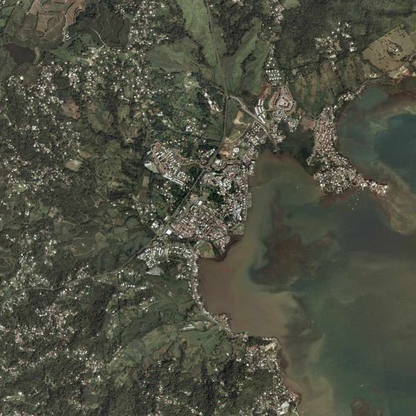
Kart over Le Lorrain
Interaktivt kart
Le Lorrain befolkning
Årene 1975 til 2020
| Data | 1975 | 1990 | 2000 | 2015 | 2020 |
|---|---|---|---|---|---|
| Befolkning | 8 941 | 7 890 | 7 658 | 6 523 | 6 634 |
| Befolkningstetthet | 211,6 / km² | 186,7 / km² | 181,3 / km² | 154,4 / km² | 157 / km² |
Kilder: JRC (European Commission's Joint Research Centre) arbeid med GHS built-up grid
Le Lorrain befolkningsendring fra 2000 til 2015
Nedgang på 14.8% fra 2000 til 2015
| Beliggenhet | Endring siden 1975 | Endring siden 1990 | Endring siden 2000 |
|---|---|---|---|
| Le Lorrain | -27% | -17.3% | -14.8% |
| Martinique | +20.6% | +11.1% | +2.7% |
Kilder: JRC (European Commission's Joint Research Centre) arbeid med GHS built-up grid
Le Lorrain medianalder
Medianalder: 42 år
| Beliggenhet | Gjennomsnittsalder | Median alder (kvinne) | Median alder (mann) |
|---|---|---|---|
| Le Lorrain | 42 yrs | 42.8 yrs | 40.9 yrs |
| Martinique | 39.5 yrs | 40.4 yrs | 38.1 yrs |
Kilder: CIESIN (Center for International Earth Science Information Network)
Le Lorrain befolkningstetthet
Befolkningstetthet: 157 / km²
| Beliggenhet | Befolkning | Område | Tetthet |
|---|---|---|---|
| Le Lorrain | 6 634 | 42,3 km² | 157 / km² |
| Martinique | 358 325 | 1 142,9 km² | 314 / km² |
Kilder: JRC (European Commission's Joint Research Centre) arbeid med GHS built-up grid
Le Lorrain historisk og prognostisert befolkning
Estimert befolkning fra 1000 til 2100
Kilder:
- JRC (European Commission's Joint Research Centre) arbeid med GHS built-up grid
- CIESIN (Center for International Earth Science Information Network)
- [link] Klein Goldewijk, K., Beusen, A., Doelman, J., and Stehfest, E.: Anthropogenic land use estimates for the Holocene – HYDE 3.2, Earth Syst. Sci. Data, 9, 927–953, https://doi.org/10.5194/essd-9-927-2017, 2017.
Prisfordeling
Bedriftsfordeling etter pris for Le Lorrain
Human Development Index (HDI)
Statistisk sammensatt indeks over forventet levealder, utdanning og inntekt per innbygger.
Kilde: [link] Kummu, M., Taka, M. &Guillaume, J. Gridded global datasets for Gross Domestic Product and Human Development Index over 1990–2015. Sci Data 5, 180004 (2018) doi:10.1038/sdata.2018.4
Le Lorrain CO2-utslipp
Utslipp av karbondioksid (CO2) per innbygger i tonn per år
| Beliggenhet | CO2-utslipp | CO2-utslipp per innbygger | CO2-utslippsintensitet |
|---|---|---|---|
| Le Lorrain | 38,305 tn | 5.77 tn | 906.6 tons/km² |
| Martinique | 1,925,583 tn | 5.37 tn | 1,684.9 tons/km² |
Kilder: [link] Moran, D., Kanemoto K; Jiborn, M., Wood, R., Többen, J., and Seto, K.C. (2018) Carbon footprints of 13,000 cities. Environmental Research Letters DOI: 10.1088/1748-9326/aac72a
Le Lorrain CO2-utslipp
| CO2-utslipp i 2013 (tonn/år) | 38,305 tn |
| CO2-utslipp i 2013 (tonn/år) per person | 5.77 tn |
| CO2-utslippsintensitet i 2013 (tonn/km²/år) | 906.6 tons/km² |
Naturlige farer
Relative risk out of 10
| Fare | Risk Level |
|---|---|
| Earthquake | Medium (5.7) |
| Cyclone | High (9) |
| Volcano | Medium (5) |
* Risk, particularly concerning flood or landslide, may not be for the entire area.
Kilder:
- Dilley, M., R.S. Chen, U. Deichmann, A.L. Lerner-Lam, M. Arnold, J. Agwe, P. Buys, O. Kjekstad, B. Lyon, and G. Yetman. 2005. Natural Disaster Hotspots: A Global Risk Analysis. Washington, D.C.: World Bank. https://doi.org/10.1596/0-8213-5930-4.
- Center for Hazards and Risk Research - CHRR - Columbia University, Center for International Earth Science Information Network - CIESIN - Columbia University, International Bank for Reconstruction and Development - The World Bank, and United Nations Environment Programme Global Resource Information Database Geneva - UNEP/GRID-Geneva. 2005. Global Cyclone Hazard Frequency and Distribution. Palisades, NY: NASA Socioeconomic Data and Applications Center (SEDAC). https://doi.org/10.7927/H4CZ353K.
- Center for Hazards and Risk Research - CHRR - Columbia University, Center for International Earth Science Information Network - CIESIN - Columbia University. 2005. Global Volcano Hazard Frequency and Distribution. Palisades, NY: NASA Socioeconomic Data and Applications Center (SEDAC). https://doi.org/10.7927/H4BR8Q45.
- Center for Hazards and Risk Research - CHRR - Columbia University, Center for International Earth Science Information Network - CIESIN - Columbia University. 2005. Global Earthquake Hazard Distribution - Peak Ground Acceleration. Palisades, NY: NASA Socioeconomic Data and Applications Center (SEDAC). https://doi.org/10.7927/H4BZ63ZS.
Nylige jordskjelv i nærheten
Størrelse 3.0 og større
| Dato▼ | Tid↕ | Magnitude↕ | Distance↕ | Dybde↕ | Beliggenhet↕ | link |
|---|---|---|---|---|---|---|
| 7/27/18 | 1:02 AM | 4.2 | 39.5 km | 157,690 m | 7km SSW of Les Trois-Ilets, Martinique | usgs.gov |
| 12/16/16 | 7:51 PM | 4.3 | 16 km | 166,500 m | 8km NW of Basse-Pointe, Martinique | usgs.gov |
| 11/17/16 | 9:53 AM | 4.5 | 22.4 km | 160,020 m | 15km NW of Basse-Pointe, Martinique | usgs.gov |
| 12/28/15 | 6:55 AM | 5.6 | 36.7 km | 150,000 m | 20km WSW of Saint-Pierre, Martinique | usgs.gov |
| 4/20/15 | 9:11 PM | 4.3 | 28.9 km | 147,730 m | 21km WNW of Basse-Pointe, Martinique | usgs.gov |
| 3/7/15 | 11:24 PM | 4.4 | 26.4 km | 127,540 m | 19km NNW of Basse-Pointe, Martinique | usgs.gov |
| 3/1/15 | 10:34 AM | 3.2 | 38.5 km | 69,200 m | 32km ENE of Petite Riviere Salee, Martinique | usgs.gov |
| 12/1/14 | 4:58 AM | 4.1 | 39.2 km | 143,950 m | 20km S of Berekua, Dominica | usgs.gov |
| 7/26/14 | 12:06 PM | 4.1 | 25.4 km | 151,530 m | 22km NNE of Basse-Pointe, Martinique | usgs.gov |
| 9/26/12 | 6:15 PM | 4.3 | 20.3 km | 169,600 m | Martinique region, Windward Islands | usgs.gov |


Om våre data
Dataene på denne siden er estimert ved hjelp av en rekke offentlig tilgjengelige verktøy og ressurser. De leveres uten garanti og kan inneholde unøyaktigheter. Bruk på eget ansvar.