Virksomheter i Sipocot
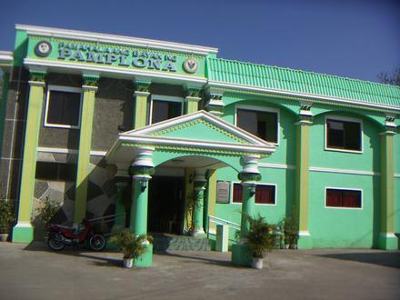
Hoteller og reiser
Restauranter
Automotiv
Økonomiske tjenester
Medisinsk
Skjønnhet og spa
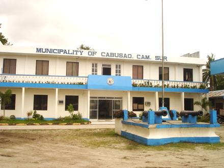
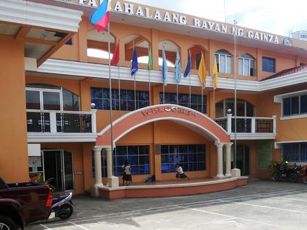
Kommune og Region
Industries
Forretningsdistribusjon etter næring Handling: 18,7 %
Undervisning: 14,2 %
Restauranter: 13,2 %
Mat: 6,9 %
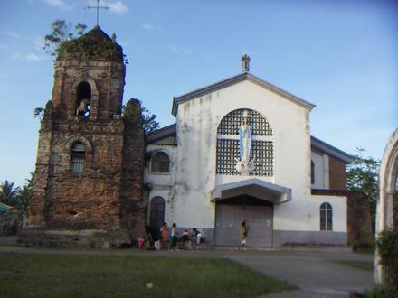
Religion: 6,6 %
Hoteller og reiser: 6,1 %
Industri: 5,8 %
Automotiv: 5,8 %
Andre: 22,7 %
| Område for Sipocot, Bicol Region | 243,4 km² |
| Befolkning | 72 992 |
| Mannlig befolkning | 37 400 (51,2 %) |
| Befolkning av kvinner | 35 592 (48,8 %) |
| Befolkningsendring fra 1975 til 2015 | +865,5 % |
| Befolkningsendring fra 2000 til 2015 | +71,3 % |
| Gjennomsnittsalder | 20,3 |
| Mannlig gjennomsnittsalder | 19,9 |
| Kvinnelig gjennomsnittsalder | 20,7 |
| Retningsnumre | 54 |
| Nabolag | Tara |
| Lokal tid | søndag 14:00 |
| Tidssone | filippinsk normaltid |
| Bredde- & lengdegrad | 13.768° / 122.9762° |
Sipocot, Bicol Region - Kart
Sipocot, Bicol Region Befolkningstetthet
År 1975 til 2015| Data | 1975 | 1990 | 2000 | 2015 |
|---|---|---|---|---|
| Befolkning | 7 560 | 25 136 | 42 602 | 72 992 |
| Befolkningstetthet | 31,1 / km² | 103,3 / km² | 175,0 / km² | 299,8 / km² |
Sipocot Befolkningsendringer fra 2000 til 2015
Økning på 71,3 % fra år 2000 til 2015| Beliggenhet | Endring siden 1975 | Endring siden 1990 | Endring siden 2000 |
|---|---|---|---|
| Sipocot, Bicol Region | +865,5 % | +190,4 % | +71,3 % |
| Camarines Sur | +567,2 % | +132,5 % | +50,8 % |
| Filippinene | +146,5 % | +63,3 % | +29,5 % |
Sipocot, Bicol Region Gjennomsnittsalder
Gjennomsnittsalder: 20,3 år| Beliggenhet | Gjennomsnittsalder | Median alder (kvinne) | Median alder (mann) |
|---|---|---|---|
| Sipocot, Bicol Region | 20,3 år | 20,7 år | 19,9 år |
| Camarines Sur | 20,3 år | 20,7 år | 19,9 år |
| Filippinene | 23,2 år | 23,6 år | 22,8 år |
Sipocot, Bicol Region Befolkningstre
Befolkning etter alder og kjønn| Alder | Mann | Kvinne | Total |
|---|---|---|---|
| Under 5 år | 4 390 | 4 279 | 8 670 |
| 5-9 | 4 957 | 4 674 | 9 631 |
| 10-14 | 4 924 | 4 490 | 9 414 |
| 15-19 | 4 493 | 3 981 | 8 475 |
| 20-24 | 3 363 | 2 860 | 6 224 |
| 25-29 | 2 495 | 2 295 | 4 790 |
| 30-34 | 2 316 | 2 152 | 4 469 |
| 35-39 | 2 070 | 2 012 | 4 082 |
| 40-44 | 2 031 | 1 932 | 3 963 |
| 45-49 | 1 727 | 1 743 | 3 470 |
| 50-54 | 1 495 | 1 472 | 2 968 |
| 55-59 | 1 142 | 1 150 | 2 292 |
| 60-64 | 824 | 944 | 1 768 |
| 65-69 | 552 | 727 | 1 279 |
| 70-74 | 410 | 536 | 947 |
| 75-79 | 212 | 346 | 558 |
| 80-84 | 0 | 0 | 0 |
| 85 Pluss | 0 | 0 | 0 |
Sipocot, Bicol Region Befolkningstetthet
Befolkningstetthet: 299,8 / km²| Beliggenhet | Befolkning | Område | Befolkningstetthet |
|---|---|---|---|
| Sipocot, Bicol Region | 72 992 | 243,4 km² | 299,8 / km² |
| Camarines Sur | 1,8 millioner | 5 171,6 km² | 347,3 / km² |
| Filippinene | 96,6 millioner | 296 939,4 km² | 325,3 / km² |
Sipocot, Bicol Region Historisk og fremtidig anslått befolkning
Estimert innbyggertall fra 1900 til 2100Sources:
1. JRC (European Commission's Joint Research Centre) work on the GHS built-up grid
2. CIESIN (Center for International Earth Science Information Network)
3. [link] Klein Goldewijk, K., Beusen, A., Doelman, J., and Stehfest, E.: Anthropogenic land use estimates for the Holocene – HYDE 3.2, Earth Syst. Sci. Data, 9, 927–953, https://doi.org/10.5194/essd-9-927-2017, 2017.
Retningsnummer
Prosent Områdekoder bruk av bedrifter i Sipocot Retningsnummer 54: 45,9 %
Retningsnummer 920: 8,1 %
Retningsnummer 921: 8,1 %
Retningsnummer 907: 5,4 %
Retningsnummer 917: 5,4 %
Retningsnummer 946: 5,4 %
Retningsnummer 2: 2,7 %
Retningsnummer 909: 2,7 %
Retningsnummer 910: 2,7 %
Retningsnummer 919: 2,7 %
Retningsnummer 927: 2,7 %
Retningsnummer 929: 2,7 %
Retningsnummer 93: 2,7 %
Retningsnummer 948: 2,7 %
Human Development Index (HDI)
Statistisk sammensatt indeks over forventet levealder, utdanning og inntekt per innbygger.Sources: [Link] Kummu, M., Taka, M. & Guillaume, J. Gridded global datasets for Gross Domestic Product and Human Development Index over 1990–2015. Sci Data 5, 180004 (2018) doi:10.1038/sdata.2018.4
Sipocot, Bicol Region CO2-utslipp
Utslipp av karbondioksid (CO2) per innbygger i tonn per år| Beliggenhet | CO2-utslipp | CO2-utslipp per innbygger | CO2-utslippsintensitet |
|---|---|---|---|
| Sipocot, Bicol Region | 80 982 am. tonn | 1,11 am. tonn | 332,7 am. tonn/km² |
| Camarines Sur | 1 886 987 am. tonn | 1,05 am. tonn | 364,9 am. tonn/km² |
| Filippinene | 104 920 564 am. tonn | 1,09 am. tonn | 353,3 am. tonn/km² |
Sipocot, Bicol Region CO2-utslipp
| 2013 CO2-utslipp (tonn/år) | 80 982 am. tonn |
| 2013 CO2-utslipp (tonn/år) per capita | 1,11 am. tonn |
| 2013 CO2-utslipp intensitet (tonn/km²/år) | 332,7 am. tonn/km² |
Naturlige farer
Relativ risiko av 10| Jordskred | Høy (8) |
| Cyclone | Høy (10) |
| Tørke | Medium (5) |
| Oversvømmelse | Høy (7) |
| Jordskjelv | Høy (8) |
* Risiko, spesielt for flom eller skred, kan ikke være for hele området.
Sources: 1. Dilley, M., R.S. Chen, U. Deichmann, A.L. Lerner-Lam, M. Arnold, J. Agwe, P. Buys, O. Kjekstad, B. Lyon, and G. Yetman. 2005. Natural Disaster Hotspots: A Global Risk Analysis. Washington, D.C.: World Bank. https://doi.org/10.1596/0-8213-5930-4.
2. Center for Hazards and Risk Research - CHRR - Columbia University, Center for International Earth Science Information Network - CIESIN - Columbia University. 2005. Global Earthquake Hazard Distribution - Peak Ground Acceleration. Palisades, NY: NASA Socioeconomic Data and Applications Center (SEDAC). https://doi.org/10.7927/H4BZ63ZS.
3. Center for Hazards and Risk Research - CHRR - Columbia University, Center for International Earth Science Information Network - CIESIN - Columbia University, and Norwegian Geotechnical Institute - NGI. 2005. Global Landslide Hazard Distribution. Palisades, NY: NASA Socioeconomic Data and Applications Center (SEDAC). https://doi.org/10.7927/H4P848VZ.
4. Center for Hazards and Risk Research - CHRR - Columbia University, Center for International Earth Science Information Network - CIESIN - Columbia University. 2005. Global Flood Hazard Frequency and Distribution. Palisades, NY: NASA Socioeconomic Data and Applications Center (SEDAC). https://doi.org/10.7927/H4668B3D.
5. Center for Hazards and Risk Research - CHRR - Columbia University, Center for International Earth Science Information Network - CIESIN - Columbia University, and International Research Institute for Climate and Society - IRI - Columbia University. 2005. Global Drought Hazard Frequency and Distribution. Palisades, NY: NASA Socioeconomic Data and Applications Center (SEDAC). https://doi.org/10.7927/H4VX0DFT.
6. Center for Hazards and Risk Research - CHRR - Columbia University, Center for International Earth Science Information Network - CIESIN - Columbia University, International Bank for Reconstruction and Development - The World Bank, and United Nations Environment Programme Global Resource Information Database Geneva - UNEP/GRID-Geneva. 2005. Global Cyclone Hazard Frequency and Distribution. Palisades, NY: NASA Socioeconomic Data and Applications Center (SEDAC). https://doi.org/10.7927/H4CZ353K.
Nylige jordskjelv i nærheten
Størrelse 3.0 og større| Dato | Tid | Omfanget | Avstand | Dybde | Beliggenhet | link |
|---|---|---|---|---|---|---|
| 10.12.2018 | 10:14 | 4,5 | 63 km | 35 000 m | 4km WSW of San Andres, Philippines | usgs.gov |
| 06.10.2018 | 07:16 | 4,2 | 19 km | 42 750 m | 4km N of Bao, Philippines | usgs.gov |
| 10.07.2016 | 04:37 | 4,5 | 32,3 km | 40 430 m | 13km W of Bao, Philippines | usgs.gov |
| 10.08.2014 | 10:36 | 4,5 | 55,9 km | 43 090 m | 2km N of Tagkawayan Sabang, Philippines | usgs.gov |
| 28.07.2011 | 12:35 | 4,1 | 42,1 km | 35 000 m | Luzon, Philippines | usgs.gov |
| 05.06.2011 | 18:51 | 3,6 | 31,1 km | 10 000 m | Luzon, Philippines | usgs.gov |
| 21.03.2011 | 06:29 | 4 | 39,3 km | 35 100 m | Luzon, Philippines | usgs.gov |
| 08.12.2010 | 01:21 | 4,4 | 36,7 km | 35 000 m | Luzon, Philippines | usgs.gov |
| 29.04.2010 | 09:46 | 5,2 | 31,4 km | 42 300 m | Luzon, Philippines | usgs.gov |
| 04.09.2008 | 10:09 | 4,2 | 64,5 km | 35 000 m | Luzon, Philippines | usgs.gov |
Finn historisk oversikt over jordskjelv i nærheten av Sipocot, Bicol Region
Tidligste dato Siste dato
Størrelse 3.0 og større Størrelse 4.0 og høyere Størrelse 5,0 og større
Postnumre
Prosent av bedrifter etter Postnumre i Sipocot Postnummer 4408: 90,5 %
Postnummer 4407: 4,8 %
Postnummer 4409: 4,8 %
Om våre data
Dataene på denne siden er estimert ved å bruke et antall offentlig tilgjengelige verktøy og ressurser. Det leveres uten garanti, og kan inneholde unøyaktigheter. Bruk på egen risiko. Se her for mer informasjon.